Welcome to TERN Knowledge Base
TERN Ecosystem Surveillance Monitoring
- TERN Data
- k.mason
TERN's 'Ecosystem Surveillance Monitoring' is a plot-based surveillance monitoring program undertaking baseline surveys of rangelands and tall eucalyptus forest ecosystems across Australia. AusPlots aims to establish and maintain a national network of permanent plots to enable consistent ecological assessment and ongoing monitoring.
To achieve consistent ecological assessment across plots, standardised data collection methods were specifically developed for TERN's Ecosystem Surveillance Monitoring program. Collectively this set of data collection methods is referred to as the 'AusPlots' methods. AusPlots methods were developed in collaboration with all ecosystem jurisdictions.
Significance
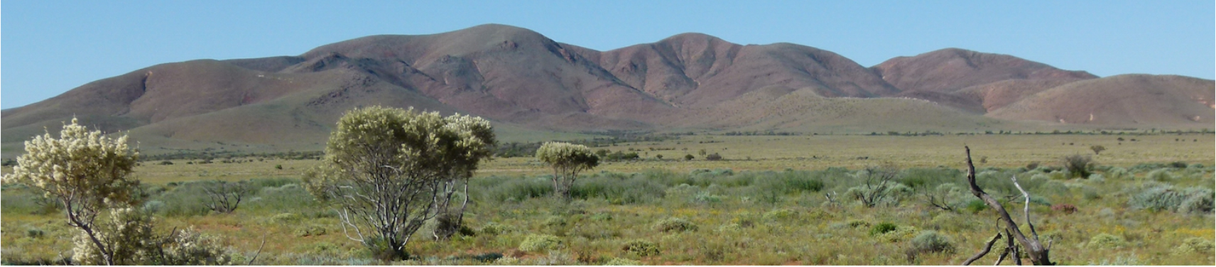
Rangelands include grasslands, shrublands, savannas, woodlands, wetlands, and deserts that are grazed by domestic livestock or wild animals. They are characterized by vast spaces, old (often infertile) soils, highly variable (often low) rainfall, diverse and variable plant & animal communities. Rangeland's ecosystems cover 81% of the Australian continent. They are understudied, with studies typically conducted at local and regional-scale and with no standardisation across studies.
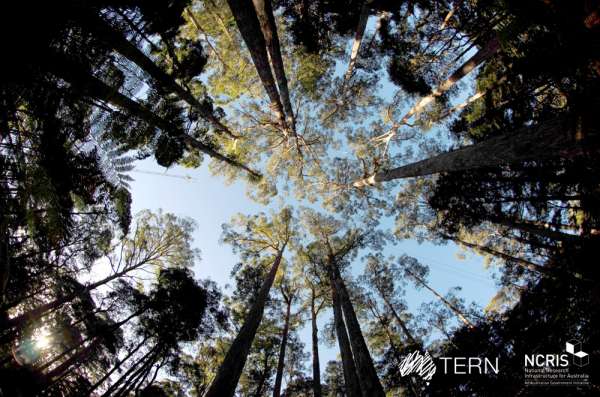
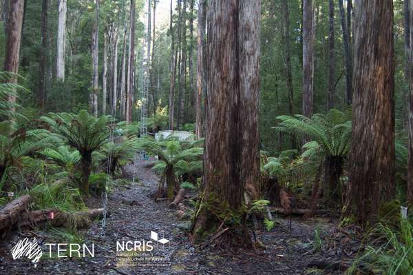
Tall Eucalyptus Forests contain some of the most iconic Australian trees. The term 'eucalypt' includes three genera (Eucalyptus, Corymbia and Angophora) and approximately 900 species, their vast majority native to Australia. Tall Eucalypt Forest consists of trees over 30m tall, some reaching heights over 100m. They include the tallest flowering plant in the world and the tallest tree species in Australia, Eucalyptus regnans (mountain ash) endemic of Tasmania and Victoria.
The data collected in TERN's Ecosystem Surveillance Monitoring program can be integrated with existing knowledge and additional data to help scientists and land managers better understand and manage Australian ecosystems. Data integration is facilitated by the 'ausplotsR' R package.
ausplotsR
'ausplotsR' is an R package that facilitates the extraction and preparation of AusPlots Rangelands data. Once the data are in the R environment, they can be visualised, integrated with additional data, and analysed. It was developed by Greg Guerin and collaborators at TERN's Ecosystem Surveillance team. It currently includes six functions, one to extract live data and 5 to prepare the data for visualisation, integration, or analysis.
Tutorial Table of Content
The TERN Ecosystem Surveillance Team at University of Adelaide
Guidelines for the Surveillance Team: Preparing and Uploading Datasets to the UQRDM
Spatial & Temporal Scope
AusPlots Methods
Applications
Monitoring statistics (so far)
Field Training
Introduction to 'ausplotsR'
Installing and Loading 'ausplotsR'
Obtaining AusPlots data: 'get_ausplots' function
Manipulating AusPlots data I: Subset data frames
Species-Level data: 'species_table' function
Manipulating AusPlots data II: Merging data frames
PROPORTIONAL VEGETATION COVER (= FRACTIONAL COVER): 'fractional_cover' function
Plant Growth Form data: 'growth_form_table' function
Vegetation Cover data: 'single_cover_value' function
Basal Area data: 'basal_area' function
Saving AusPlots data
AusPlots Rangelands Manual v1.2.9
Background Knowledge
How to use TERN's Ecosystem Surveillance Monitoring Data
Step-by-Step Guides
- Introduction to 'ausplotsR'
- Installing and Loading 'ausplotsR'
- Obtaining AusPlots data: 'get_ausplots' function
- Manipulating AusPlots data I: Subset data frames
- Species-Level data: 'species_table' function
- Manipulating AusPlots data II: Merging data frames
- Vegetation Fractional Cover data: 'fractional_cover' function
- Plant Growth Form data: 'growth_form_table' function
- Vegetation Cover data: 'single_cover_value' function
- Basal Area data: 'basal_area' function
- Saving AusPlots data
Hands-on Complete Tutorials
- Ecosystem Surveillance GitHub site
- Ecosystem Surveillance Basic Tutorial
- Ecosystem Surveillance Tutorial
- Ecosystem Surveillance Examples
Further Information
- Ecosystem Surveillance Presentation (IntrotoTERNsEcosystemMonitoring.pptx)
- Ecosystem Surveillance Supplementary Materials (TERN_AusPlots_Desc.pdf)
- TERN's Ecosystem Surveillance Monitoring Website
- AusPlots Rangelands Survey Protocols Manual
Related content
Provide your feedback about the experience with Knowledge base