Persistent URL http://auscover.org.au/purl/mangrove-airborne-lidar-leichardt-2012
Link to the data This data set consists of two .tif files, with these being a canopy height models (CHM) and underlying Digital Terrain Models (DTMs) for mangroves at the mouth of the Leichhardt River, Gulf of Carpentaria, Queensland. The raw data are available from Airborne Research Australia (ARA). The list and details of the CHMs and DTMs derived from the tiled data is given in the section ‘File Attributes’. Georeferencing and other information on image dimensions of the files are provided in the section on Spatial and Temporal extents.
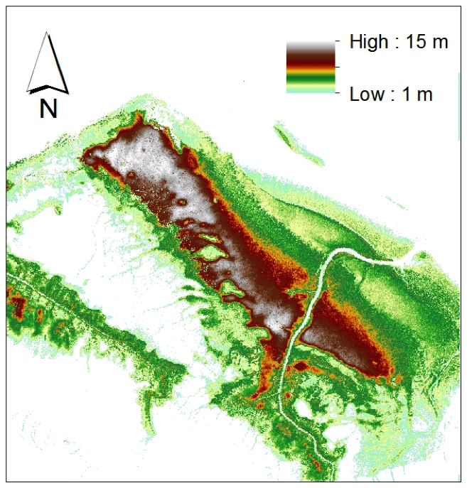
Abstract or Summary LiDAR data (1 m post spacing; 24 strips approximating 1 km in width) were acquired over the mangroves at the mouth of the Leichhardt River in 2012 by Airborne Research Australia (ARA). From the LiDAR data acquired over mangroves at the mouth of the Leichhardt River, a Digital Terrain Model (DTM) and a Canopy Height Model (CHM) were generated at 1 m spatial resolution using SPDLib software and the procedures outlined by Bunting et al. (2013). To identify ground returns for use in the DTM generation, a Progressive Morphological Filter (PMF; Zhang et al. 2003) algorithm was applied in combination with the Multi-Scale Curvature (MCC; Evans and Hudak 2007) algorithm. The CHM was then defined in relation to the DTM and interpolated using a natural neighbor algorithm.
Data quality Absolute vertical accuracy: ± 0.20 m vertical accuracy at 1σ. The absolute vertical accuracy is the uncertainty of a measured elevation compared to the true elevation with respect to the established datum. Ellipsoid heights should be reduced to AHD using the AUSGeoid09 model. Relative vertical accuracy: ± 0.10 m at 2σ. This is the uncertainty of the measured elevation of one point with respect to another point (point-to-point accuracy) within and across adjacent flight lines. Absolute horizontal accuracy: ±0.30 m at 1σ. The IMU unit / INS system meets the f flight limit specifications recommended by ASPRS, namely ≤ 0.005o for roll; ≤ 0.005o for pitch; and ≤ 0.008o for heading (i.e. yaw).