 Landscapes - Remote Sensing
TERN's Landscapes Assessment is a platform that conducts environmental monitoring using remote sensing techniques to characterise and monitor Australian ecosystems at a landscape and continental scale.
Data
Remote sensing (RS) data includes validated geodata from satellite and airborne platforms such as aircraft and unmanned aerial vehicles (UAVs; i.e. drones). The platform also undertakes synthesis and modelling activities to extrapolate and interpolate from observational data to produce modelled data products.
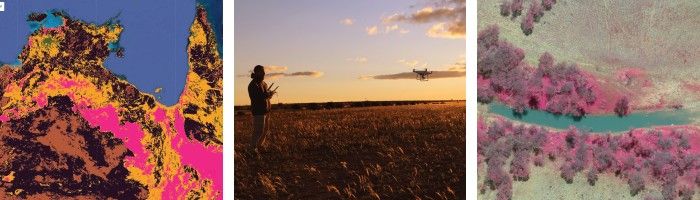
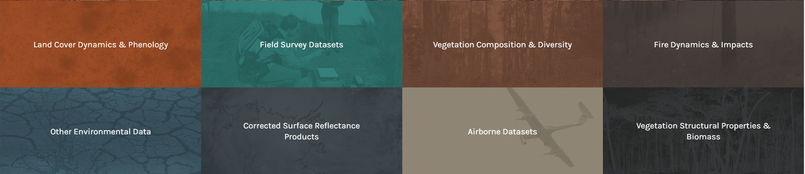
TERN's Landscape Assessment RS data streams can broadly be classified into eight 'Themes'. Themes, include among others land cover dynamics & phenology, vegetation composition & diversity, vegetation structural properties & biomass, as well as bushfire dynamics & impacts. A data stream can belong to more than one theme.
The data result from the collaboration of over 12 Australian government and academic institutions. This collaboration provides a nationally consistent methodology for the calibration of instruments, as well as the collection, validation, and delivery of geodata products. TERN Landscape Assessment RS data is delivered primarily by the TERN facility formerly known as TERN AusCover.
Significance
TERN's Landscape Assessment RS data streams are used to detect and characterise ecosystem change at a landscape and continental scale. The resulting geodata products enable researches and resource managers to assess and investigate the state and dynamics of Australian environments.
Background Knowledge
- Surface Reflectance
- Vegetation Indices
- Cover Data Products
- Ecosystem Disturbance Index
- Phenology
- Fire Dynamics & Impacts
- Limitations of TERN's RS Data Products
- Satellites Capturing TERN's RS Data
How to use TERN's Remote Sensing Data
Step-by-Step Guides
- Rasters in R
- Set up: Getting ready
- Loading rasters
- Combine single layer rasters into a multiple-layer raster
- Coordinate Reference System (CRS) in Rasters
- Subsetting data in space (cropping rasters)
- Subsetting data in time (select raster layers)
- Raster Values: Visualisation (plot rasters)
- Raster Values: Numerical summaries
- Raster Values: Graphical summaries
- Raster Calculations: Raster Algebra & Higher Level Functions
- Saving rasters
Hands-on Complete Tutorials
- Landscapes Assessment - Remote Sensing GitHub site
- Using Raster Data in R Tutorial
- Effects of Cyclone Yasi on Green Cover at Mission Beach Turtorial
- Green Vegetation Temporal Dynamics Tutorial (Parts 1 & 2)
Further Information
- Landscapes Assessment - Remote Sensing Supplementary Materials (TERN_LandscapeAssessment_RS_Desc.pdf)
- TERN's Landscape Assessment (AusCover) Website