Field Calibration/Validation Data
This page contains information and resources relating to the collection and management of field data by TERN and the Queensland Department of Environment and Science. For information on how this field data is used to validate Australian fractional cover products, see Chapter 7 of the AusCover Good Practice Guidelines. For any further information regarding the field datasets, please contact rebecca.farrell@des.qld.gov.au.
TERN collects and hosts data for a number of core remote sensing field calibration/validation data sets at sites Australia wide. These data sets include:
Airborne Data (Hyperspectral, LiDAR and Thermal)
Hyperspectral Ground Calibration Data
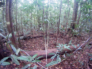
SLATS star transects
Ground LiDAR
UAV Flights
Pasture Biomass Data
Tree structural characteristics
Hemispherical photography
Aerosol optical depth and ozone
Leaf sampling (spectra and chemistry)
Leaf area index (LAI)
Sites doc
upload V6
Data access
tlsviewer
data.tern > linked from individual records
sitedata/lat_lon/date/type - updated by DES
site_collections > check update status, vs site doc v6
vegetation_structure > old?
Filenaming and conventions
Contributing
ODK forms
Workflow summary
ODK (agg, form/phone, agg) > DES > json, python (postgres + file storage) >> data.tern/sitedata >> field.jrsrp (postgis + geoserver)
Field data collections
Supplementary information for each collection that may not be included in the corresponding TERN Portal record.
Biomass Plot Library
Collation of stem inventory data and biomass estimation
Terrestrial laser scans - DWEL
Processed instrument files and ancillary data
Terrestrial laser scans - Riegl VZ400
Raw instrument files and ancillary data
Individual tree point clouds and cylinder models, Rushworth Forest
Hyperspectral ground calibration data
Spectroradiometer, raw spectroradiometer instrument files and ancillary data
SLATS Star transects
Point intercept and field measurements, vegetation measurement summaries, point intercept data, ancillary data and field photos
Tree structural characteristics
Field measurements, ancillary data and field photos
Hemispherical photography
Digital camera and hemispheric lens, raw imagery and ancillary data
Sunphotometer Aerosol Optical Depth
Microtops, instrument data
Sunphotometer Ozone
Microtops, instrument data
Leaf samples
Leaf scans, leaf spectra and attribute data)
(no record, no data .. yet)
Leaf Area Index
Raw instrument data, hemispheric photography and attribute data)
(no record, no data .. yet)
Complementary field validation collections
Airborne LiDAR and Hyperspectral
ANU/CSIRO
Australian ground cover reference sites database
ABARES
Hyperspectral Surface Reflectance
Hyperion, Enhancement and atmospheric correction technique