...
Field Label | Steps |
|---|---|
Provide a site description (optional) | Describe the general location of the study site. Eg. The Alice Springs Mulga flux station is located on Pine Hill cattle station, near Alice Springs in the Northern Territory. |
Limits (optional) | 2 methods:
|
Coordinate Reference System (optional) | Select an appropriate reference system. A commom reference system by most hand held GPS is WGS84 - EPSG:4326 |
...
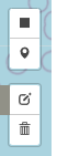 | Tool set to mark the points on the map | |
 | Quadrilateral Draw tool Click and drag to draw a rectangle 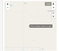 Click and drag the cross hair from beginning point diagonally to mark a four sided polygon area. | The longitude and latitude of the location will be shown as per below: 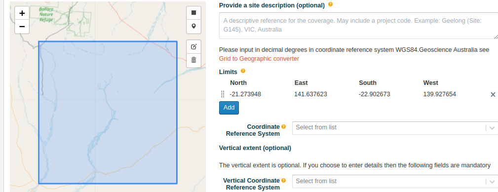 |
 | Location marker on the map Click to select the icon and pin a point on the map 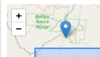 | Any amendments to the coordinates using the Mapping tools will be reflected under the Limits section, displaying the longitude and latitude of the location as per below: 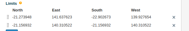 |
 | Use this tool to edit the points created with above tools Once this icon is clicked, the points on the map will be highlighted. 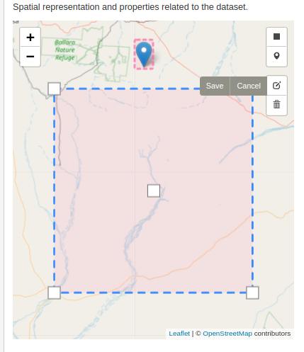 Select either the location map or the polygon on the map that needs to be amended/changed Location map - Click, Drag and drop at required location Polygon -
OR 2. Click the center of the polygon to move the entire shape. | |
 | This icon will delete the Location on map or the polygon as required. |
...
| Filter by label (Content by label) | |||||||||||||||||||||
|---|---|---|---|---|---|---|---|---|---|---|---|---|---|---|---|---|---|---|---|---|---|
|
| Page Properties | ||
|---|---|---|
| ||
|