...
Airborne Data (Hyperspectral, LiDAR and Thermal)
Hyperspectral Ground Calibration Data
SLATS star transects
Ground LiDAR
UAV Flights
Pasture Biomass Data
Tree structural characteristics
Hemispherical photography
Aerosol optical depth and ozone
Leaf sampling (spectra and chemistry)
Leaf area index (LAI)
...
Field Data Collection Protocols
TERN collects data for a number of core remote sensing calibration and validation data sets at several locations across Australia. This link contains the specific field data collection protocols used for each data set.
Field Data Collection Forms
TERN data collection tools for each of the core data sets consists of an electronic (Open Data Kit) form and a supporting paper form. This link contains details of how to access and use the electronic forms, as will as links to download the hard-copy paper forms
Field Data Filenaming Convention
The TERN field data filenaming convention for instrument files has been adopted from the established Queensland DES’s Remote Sensing Centre convention. This convention has numerous benefits facilitating automated processing. Each product's metadata contains some specific information on it's filenaming, however, this link provides greater detail on the development and standards of the convention.
Sites doc
upload V6
Access to the Field Data
...
tlsviewer
data.tern > linked from individual records
sitedata/lat_lon/date/type - updated by DES
site_collections > check update status, vs site doc v6
vegetation_structure > old?
Filenaming and conventions
Contributing
ODK forms
...
Field Data Management System
ODK (agg, form/phone, agg) > DES > json, python (postgres + file storage) >> data.tern/sitedata >> field.jrsrp (postgis + geoserver)
Field data collections
Supplementary information for each collection that may not be included in the corresponding TERN Portal record.
Biomass Plot Library
Collation of stem inventory data and biomass estimation
Terrestrial laser scans - DWEL
Processed instrument files and ancillary data
Terrestrial laser scans - Riegl VZ400
Raw instrument files and ancillary data
Individual tree point clouds and cylinder models, Rushworth Forest
Hyperspectral ground calibration data
Spectroradiometer, raw spectroradiometer instrument files and ancillary data
SLATS Star transects
Point intercept and field measurements, vegetation measurement summaries, point intercept data, ancillary data and field photos
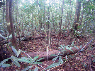
Tree structural characteristics
Field measurements, ancillary data and field photos
Hemispherical photography
Digital camera and hemispheric lens, raw imagery and ancillary data
Sunphotometer Aerosol Optical Depth
Microtops, instrument data
Sunphotometer Ozone
Microtops, instrument data
Leaf samples
Leaf scans, leaf spectra and attribute data)
(no record, no data .. yet)
Leaf Area Index
Raw instrument data, hemispheric photography and attribute data)
(no record, no data .. yet)
Complementary field validation collections
Airborne LiDAR and Hyperspectral
ANU/CSIRO
Australian ground cover reference sites database
ABARES
Hyperspectral Surface Reflectance
...