...
A large number of marine and terrestrial environmental datasets are available over varying spatial scales and temporal frequencies for Australia and the integration of these is highly beneficial to understanding the states and dynamics of mangroves around the Australian coastline. TERN is providing links to these data to enable scientists to understand the drivers and impacts of change.
| Expand |
|---|
|
The marine and near coastal environment has a major impact on mangrove states and conditions, with these including: 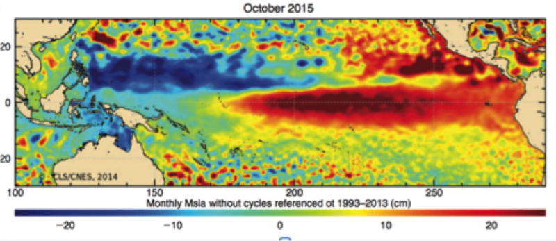 Image Added Image Added | |
|
| Expand |
|---|
|
The distribution, structure and diversity of Australian mangrove ecosystems is determined and influenced by climate, and particularly temperature and rainfall. Mangrove species diversity broadly declines with increasing latitude from a maximum of 39 species in the Wet Tropics Bioregion to 1-2 in drier regions and southern range extremities (i.e., Avicennia marina). Rainfall is generally higher on the coastal margins although highly variable and, in the northern regions, occurs mainly in the summer months, largely because of monsoon systems. This frequently results in high humidity and frequent flooding. Further south, rainfall is greatest in the winter months as frontal systems are more frequent. The tropical regions in the north of Australia is subject to both severe cyclone events. This regions is also subject to climatic variability which can contribute to fluctuations in sea level, which can exceed several tens of centimeters in this region. Information on weather and climate, where available, can be accessed through the links below. Temperature | 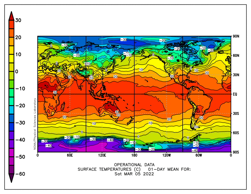 Image Added Image Added | Rainfall | 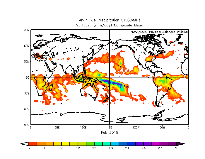 Image Added Image Added | Humidity | 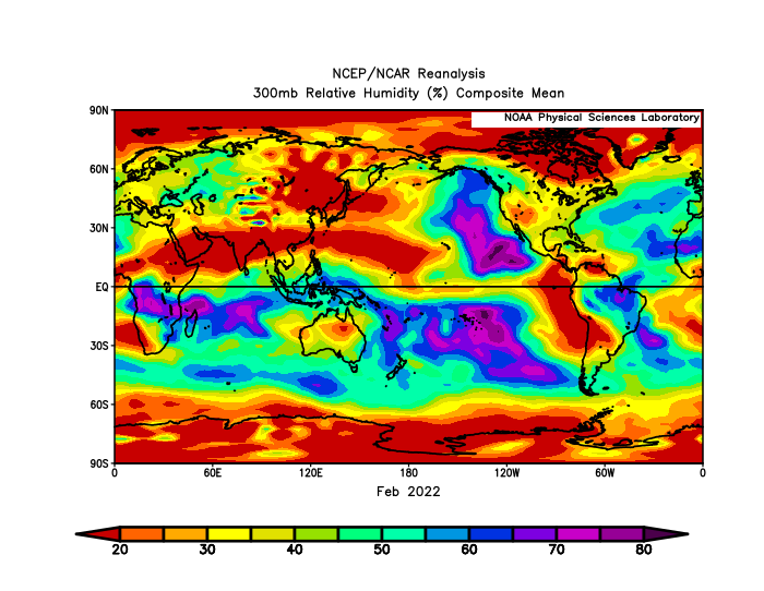 Image Added Image Added | Cyclones and tropical stormsTime series of tropical cyclone "best track" position and intensity data are provided for all ocean basins where tropical cyclones occur. Position and intensity data are available at 6-hourly intervals over the duration of each cyclone's life. The general period of record begins in 1851, but this varies by ocean basin. See the inventories for data availability specific to each basin. This data set was received as a revision to an NCDC tropical cyclone data set, with data generally available through the late 1990s. Since then, the set is being continually updated from the U.S. NOAA National Hurricane Center and the U.S. Navy Joint Typhoon Warning Center best track archives. https://rda.ucar.edu/datasets/ds824.1/
| |
|